Columbus and The Legacy of Genocide

October 12th is Columbus Day, a day which is increasingly coming under criticism for celebrating a genocidal pirate, murderer, rapist, and enslaver who is credited with the “discovery” of the Western Hemisphere.

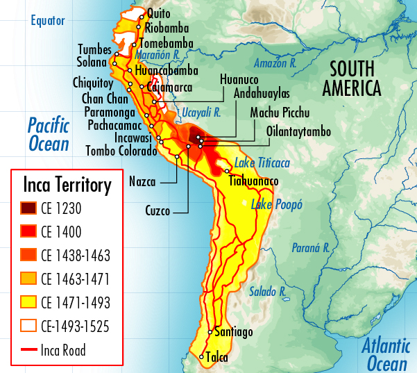
Most people today dismiss the notion that Columbus “discovered” a land that was already packed with 100 million people and 6,000 years of thriving civilizations (the earliest urban center with communal architecture is at Porvenir, Peru, dating back to 4930 B.C., according to Haas et al, 2004).

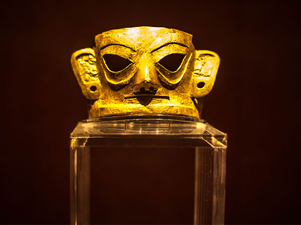
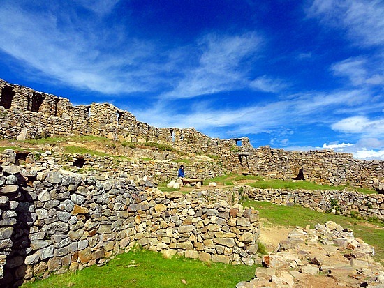
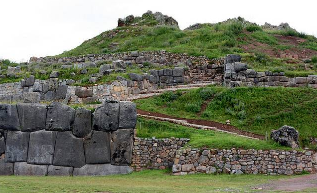
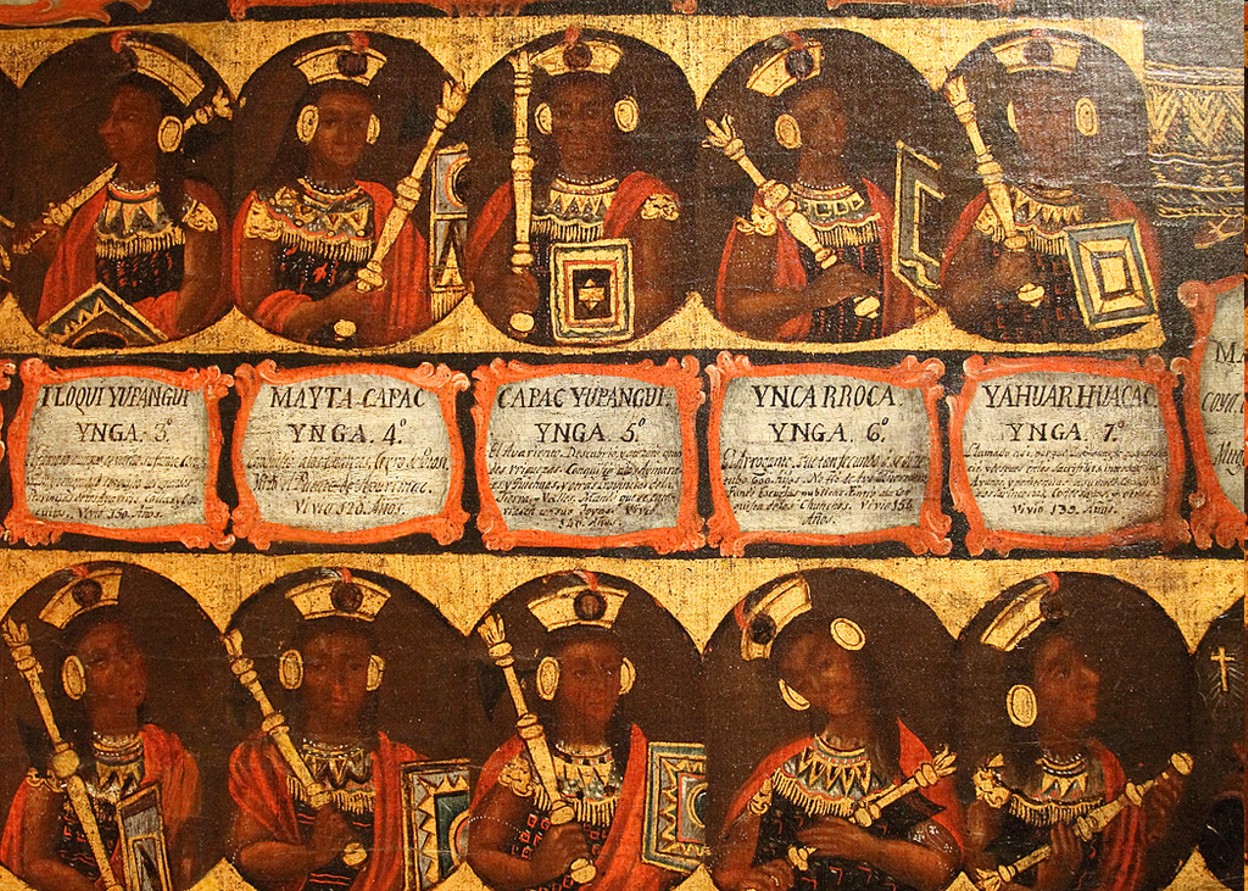
The world that Europeans “encountered” (read: “invaded”) was not that of a barren wilderness, sparsely populated by nomadic tribes; but a continent filled with wealthy, urban civilizations and complex, sedentary farming cultures. The Western Hemisphere of 1492 was a land of cities, writing, mathematics, astronomy, calendars, and engineering (listen to the Charles Mann interview for more information).

Unknown to most people is the enormity of Columbus’ genocidal actions, as well as its deadly legacy lasting into modern times. Genocide expert David Stannard has asserted that, beginning in 1492 with Columbus,  Europeans collectively killed between 70 million to 100 million Indigenous People (within 80 years). In his book American Holocaust, Stannard calls this “the largest ongoing holocaust in the history of humanity.” The consequences of this Indigenous Holocaust were world-changing: 95% of Indigenous People were killed by European actions, 100% of Indigenous lands were stolen, and European-descent people became the most prosperous people on the planet.

Background on Columbus

Spain was the perfect place for pirate and slave-trader Christopher Columbus to go as he looked for financial backing for further naval exploitations. In 1492, Spain was an environment hot with the fervor of Holy Wars against Muslims and the expulsions of Jews out of Spain.

The following video by Nican Tlaca University explains more:

http://www.youtube.com/watch?v=o51LPfrjsqQ

Acts of Genocide

The genocidal actions of Columbus and other Europeans who followed in his footsteps (e.g. Cortes, DeSoto, Pizarro, et al) can be classified into two general categories:

Biological genocide: spreading smallpox as a weapon of warfare, massacres of unarmed delegates, execution of leaders, death marches, death-by-torture, death-by-exhaustion/malnutrition, etc.

Cultural genocide: the deliberate destruction of books, buildings, and other cultural assets for the purpose of undermining cultural identity, development, and self-determination.

The following video by Nican Tlaca University describes more:

http://www.youtube.com/watch?v=DD80NJj0FzU 

Genocide Sanctioned By Law

It was the Catholic Church which established a “Genocide By Law” tradition through the issuing of Papal Bulls (Christian Declarations), granting European-Christians the rights to invade, enslave, and plunder the lands of non-Christians.

This tradition of Church-sanctioned crime led to the Doctrine of Discovery, which stated that Europeans have the right to invade, steal, rape, enslave, and colonize worldwide people and lands in the name of Jesus Christ and “salvation”. This doctrine was perhaps nowhere more blatant than in the Spanish-colonial tradition of reading aloud document called The Requirement, just before invading Indigenous lands. An excerpt from The Requirement is as follows:

“But if you do not do this, and maliciously make delay in it, I certify to you that, with the help of God, we shall powerfully enter into your country, and shall make war against you in all ways and manners that we can, and shall subject you to the yoke and obedience of the Church and of their highnesses; we shall take you, and your wives, and your children, and shall make slaves of them, and as such shall sell and dispose of them as their highnesses may command; and we shall take away your goods, and shall do you all the mischief and damage that we can, as to vassals who do not obey, and refuse to receive their lord, and resist and contradict him: and we protest that the deaths and losses which shall accrue from this are your fault, and not that of their highnesses, or ours, nor of these cavaliers who come with us “.source: https://en.wikipedia.org/…

Other legal methods of codifying destruction and subordination were:

The 1577 Law of Book Burning – this Spanish law demanded the burning of all Indigenous books.

Spanish Inquisition imported from Spain – most people associate the Inquisition and its horrors with Europe. But the Inquisition was also imported into Spanish Colonies.

Racial caste system – White Supremacy was codified into a “bloody purity” caste system which still survives today (albeit informally).

Encomienda system (slavery) – this slave system granted entire Indigenous communities over to Spaniards who could work them to death, rape them, and otherwise act with impunity.

Reservation/Reserves – mainly practiced in “The United States” and Canada, this practice herded Indigenous People – like animals — onto barren, unwanted lands.

The Columbus Formula

The Columbus Formula was replicated by subsequent European invaders. Briefly, the Columbus Formula included the following:

  • Pretend to come in peace, bringing “freedom” or “salvation”
  • Massacre unarmed people
  • Take the leader hostage
  • Extort the population for gold, silver
  • Murder the leader
  • Terrorize the population
  • Fan the flames of smallpox infection

Much of this may sound familiar in our age of “The Bush Doctrine”, whereby American foreign policy is based on “pre-emptive war” (invasion) in the name of  “Democracy” and ‘Freedom”. Just as the American government is a direct descendant of European Colonial governments, so too is modern American foreign policy a direct descendant of European-Colonial “Indian Policy”.


Modern Legacy of Genocide Since 1492

  • Poverty for Indigenous People
  • Racial Caste System still in effect (informally)
  • “Illegal Immigration” (Indigenous People are classified as criminals for migrating across European-colonial borders.)
  • Reservations
  • Forced Sterilization of Indigenous Women
  • Indian Schools (the most famous are the Indian Boarding Schools, but these have their origins in the missionary schools of early colonial Mexico. These school systematically exterminated Indigenous culture: languages, writing, mathematics, theology, and pride.)
  • Latino/Hispanic (an attempt to whitewash the Indigenous-descent population, making them a sub-category of Spanish imperialism.)
  • Manifest Destiny (the theft of Indigenous lands and parceling it out to white settlers)
  • United Fruit Company and  Monsanto – corporate colonialism of lands and resources
  • Genocide of Mayans in Guatemala 1980s  – hundreds of thousands were killed by paramilitary forces funded by the United States.
  • Bush Doctrine – pre-emptive invasion in the name of “saving them with Democracy”.
  • IMF, WTO, World Bank – this “triad” oversees (read: strong-arms) the world economy on behalf of “The West”. These institutions are run by Europeans to “develop” non-white nations, charging them huge interest on debts loaned out with numerous “structural reform” strings attached.

Conclusion

Columbus Day is more than just a holiday celebrating a man who merely “mistreated the natives”. “Mistreatment”, “depopulation”, and other euphemisms for genocide, torture, rape, and enslavement do an injustice to the horror story that is The Columbus Genocide Legacy. Columbus Day honors the architect of 521 years of continuous genocidal actions against Indigenous People.

To criticize Columbus Day merely on the notion that he did not “discover” an already-inhabited hemisphere is inadequate. The real significance of Columbus Day lies in the fact he established the Indigenous Holocaust Formula, leading to the extermination of 70 million to 100 Million Indigenous People and the theft of Indigenous lands.

This genocide paved the way for Europeans to acquire lands for “free”. The enormous wealth of the Western Hemisphere transformed Europe into a wealthy continent, and provided white settlers with “opportunities” which they would not have otherwise found back inside Europe.

Today, “Corporate Conquistadors” continue to plunder the world on behalf of “The West” (European-descent people), plundering natural resources from those who need them the most, and imposing poverty-producing conditions on struggling economies.

The cultural genocide continues today as well. A current proposal is underway to construct a “Museum of the American Latino” which plans to glorify Spaniards and their colonial past, while subsuming Indigenous-descent people under the categories of Hispanic/Latino, as a way of erasing their identity and voices.

imagesVFWUYHB4

10462735_29911

                                                         10320529_289058

Sources:

The Journals of Columbus

Destruction of the Indies

Education For Extinction

Kill The Indian, Save The Man

Genocide: A Comprehensive Introduction

American Indian Contributions to the World

1491: New Revelations on the Americas

Year 501: The Conquest Continues by Noam Chomsky

Pagans In The Promised Land: Decoding The Doctrine of Discovery

http://www.dailykos.com/story/2013/10/12/1246553/-Columbus-and-The-Legacy-of-Genocide

Visit the Nican Tlaca Facebook page for more information

Beyond Angkor: How lasers revealed a lost city

Angkor Wat temple

Deep in the Cambodian jungle lie the remains of a vast medieval city, which was hidden for centuries. New archaeological techniques are now revealing its secrets – including an elaborate network of temples and boulevards, and sophisticated engineering.

In April 1858 a young French explorer, Henri Mouhot, sailed from London to south-east Asia. For the next three years he travelled widely, discovering exotic jungle insects that still bear his name.

Today he would be all but forgotten were it not for his journal, published in 1863, two years after he died of fever in Laos, aged just 35.

Mouhot’s account captured the public imagination, but not because of the beetles and spiders he found.

Readers were gripped by his vivid descriptions of vast temples consumed by the jungle: Mouhot introduced the world to the lost medieval city of Angkor in Cambodia and its romantic, awe-inspiring splendour.

“One of these temples, a rival to that of Solomon, and erected by some ancient Michelangelo, might take an honourable place beside our most beautiful buildings. It is grander than anything left to us by Greece or Rome,” he wrote.

His descriptions firmly established in popular culture the beguiling fantasy of swashbuckling explorers finding forgotten temples.

Today Cambodia is famous for these buildings. The largest, Angkor Wat, constructed around 1150, remains the biggest religious complex on Earth, covering an area four times larger than Vatican City.

It attracts two million tourists a year and takes pride of place on Cambodia’s flag.

Dr Dan Penny finds medieval carvings under a stone bridge in the Cambodian jungle


But back in the 1860s Angkor Wat was virtually unheard of beyond local monks and villagers. The notion that this great temple was once surrounded by a city of nearly a million people was entirely unknown.

It took over a century of gruelling archaeological fieldwork to fill in the map. The lost city of Angkor slowly began to reappear, street by street. But even then significant blanks remained.

Then, last year, archaeologists announced a series of new discoveries – about Angkor, and an even older city hidden deep in the jungle beyond.

An international team, led by the University of Sydney’s Dr Damian Evans, had mapped 370 sq. km. around  Angkor in  unprecedented detail – no mean feat given  the  density  of  the  jungle and the prevalence of landmines from Cambodia’s civil war. Yet the entire survey took less than two weeks.

Their secret?

Lidar – a sophisticated remote sensing technology that is revolutionising archaeology, especially in the tropics.

Mounted on a helicopter criss-crossing the countryside, the team’s lidar device fired a million laser beams every four seconds through the jungle canopy, recording minute variations in ground surface topography.

The findings were staggering.

Image showing what is beneath the ground at Angkor


The archaeologists found undocumented cityscapes etched on to the forest floor, with temples, highways and elaborate waterways spreading across the landscape.

“You have this kind of sudden eureka moment where you bring the data up on screen the first time and there it is – this ancient city very clearly in front of you,” says Dr Evans.

These new discoveries have profoundly transformed our understanding of Angkor, the greatest medieval city on Earth.

Relief map of Mahendraparvata


At its peak, in the late 12th Century, Angkor was a bustling metropolis covering 1,000 sq km. (It would be another 700 years before London reached a similar size.)

Angkor was once the capital of the mighty Khmer empire which, ruled by warrior kings, dominated the region for centuries – covering all of present-day Cambodia and much of Vietnam, Laos, Thailand and Myanmar. But its origins and birthplace have long been shrouded in mystery.

A few meagre inscriptions suggested the empire was founded in the early 9th Century by a great king, Jayavarman II, and that his original capital, Mahendraparvata, was somewhere in the Kulen hills, a forested plateau north-east of the site on which Angkor would later be built.

But no-one knew for sure – until the lidar team arrived.

The lidar survey of the hills revealed ghostly outlines on the forest floor of unknown temples and an elaborate and utterly unexpected grid of ceremonial boulevards, dykes and man-made ponds – a lost city, found.

Most striking of all was evidence of large-scale hydraulic engineering, the defining signature of the Khmer empire.

By the time the royal capital moved south to Angkor around the end of the 9th Century, Khmer engineers were storing and distributing vast quantities of precious seasonal monsoon water using a complex network of huge canals and reservoirs.

Harnessing the monsoon provided food security – and made the ruling elite fantastically rich. For the next three centuries they channelled their wealth into the greatest concentration of temples on Earth.

One temple, Preah Khan, constructed in 1191, contained 60t of gold. Its value today would be about £2bn ($3.3bn).

Angkor Wat

But despite the city’s immense wealth, trouble was brewing.

At the same time that Angkor’s temple-building programme peaked, its vital hydraulic network was falling into disrepair – at the worst possible moment.

The end of the medieval period saw dramatic shifts in climate across south-east Asia.

Tree ring samples record sudden fluctuations between extreme dry and wet conditions – and the lidar map reveals catastrophic flood damage to the city’s vital water network.

With this lifeline in tatters, Angkor entered a spiral of decline from which it never recovered.

In the 15th Century, the Khmer kings abandoned their city and moved to the coast. They built a new city, Phnom Penh, the present-day capital of Cambodia.

When Mouhot arrived he found only the great stone temples, many of them in a perilous state of disrepair.

Nearly everything else – from common houses to royal palaces, all of which were constructed of wood – had rotted away.

The vast metropolis that once surrounded the temples had been all but devoured by the jungle.

Watch the first episode of Jungle Atlantis on Thursday 25 September at 20:00 BST on BBC Two, or catch it later on the BBC iPlayer. The programme was made in association with The Smithsonian Channel, which will be transmitting both episodes in the US on 5 October under the title Angkor Revealed.

http://www.bbc.com/news/magazine-29245289


Ten incredible texts from our ancient past

http://www.ancient-origins.net/news-history-archaeology-ancient-places/ten-incredible-texts-our-ancient-past-002026

Ten incredible texts from our ancient past

There are literally thousands of incredible texts that have survived from the ancient world, which are etched onto copper, beautifully inscribed on papyrus, chipped onto tablets, and even written using the ink of ground down gold and precious stones. While it is impossible to choose the best of the bunch, we have chosen ten incredible texts to feature, which have served to open a window onto the daily lives of our ancestors and enhanced the knowledge we hold about our ancient past. 

1. The Dunhuang Manuscripts

The Dunhuang Manuscripts

The Dunhuang Manuscripts are a cache of around 20,000 important scrolls found in the Mogao Caves of Dunhuang. The Dunhuang manuscripts date to between the 5th and 11th centuries A.D., and were sealed up in a chamber in a cave, hidden for about 900 years. Although the Dunhuang Manuscripts contain mostly Buddhist texts, there were other forms of sacred texts as well. These include Taoist, Nestorian Christian, and Manichaean texts. In addition, there were also secular texts that dealt with various areas of knowledge, such as mathematics, history, astronomy and literature. One of the significant aspects of the Dunhuang Manuscripts can be seen in the large amount of folk literature in it. As this form of literature is about the lives of ordinary people, it provides a unique perspective on their experiences, the way they associated with the wider society and the government, as well as their relationships with family and friends.

2. The Kangyur Written with 9 Precious  Stones   The Kangyur Written with 9 Precious Stones

  Tibetans practised a form of Shamanism called Bon. From the 6th to 8th centuries A.D., Buddhism slowly penetrated this mountainous region. The teachings of the Buddha were translated into Tibetan, but its final compilation was only achieved in the 14th century. This resulted in the creation of the Tibetan Buddhist Canon, which consisted of the Kangyur, the “translated words (of the Buddha)”. As copies were made of the original Kangyur, this text was disseminated throughout Tibet.  One of these copies is the Kangyur written with 9 precious stones, which is the only copy in the world. The ink used in the writing of this Kangyur is literally made from precious stones. 9 types of ‘precious stones’, namely gold, silver, coral, pearl, mother of pearl, turquoise, lapis lazuli, copper and steel, were first made into powder and placed into cups designated for each ‘stone’. Some fresh water from a mountain spring or rain water would then be mixed with special sweet adhesives, goat’s milk, and added to the cups to produce the ink. Then, using a painting brush made of sable fur, the ink would be used to write on processed black paper. In addition to the text, paintings were also added to the Kangyur. These images were painted according to the artistic tradition of Zanabazar, and is said to “immediately give peace of mind and admiration to anybody who looks at it.”    

3. The Legendary Emerald Tablet   

The Legendary Emerald Tablet

 The Emerald Tablet is said to be a tablet of emerald or green stone inscribed with the secrets of the universe. The source of the original Emerald Tablet is unclear, hence it is surrounded by legends. The most common legend claims that the tablet was found in a caved tomb under the statue of Hermes in Tyana, clutched in the hands of the corpse of Hermes Trismegistus himself. Another legend suggests that it was the third son of Adam and Eve, Seth, who originally wrote it. Others believed that the tablet was once held within the Ark of the Covenant. Some even claim that the original source of the Emerald Tablet is none other than the fabled city of Atlantis.  The Emerald Tablet would become one of the pillars of Western alchemy. It was a highly influential text in Medieval and Renaissance alchemy, and probably still is today. In addition to translations of the Emerald Tablet, numerous commentaries have also been written regarding its contents.  Yet, despite the various interpretations available, it seems that none of their authors claim to possess knowledge of the whole truth. Furthermore, readers are encouraged to read the text and try to interpret and find the hidden truths themselves. 

 4. The Egyptian Dream Book

The Egyptian Dream Book

The Egyptian ‘Dream Book’ is preserved in the form of a papyrus with a hieratic script. This papyrus was found in the ancient Egyptian workers’ village of Deir el-Medina, near the Valley of the Kings. This papyrus has been dated to the early reign of Ramesses II (1279-1213 B.C.). Each page of the papyrus begins with a vertical column of hieratic signs which translates as ‘If a man sees himself in a dream’. In each horizontal line that follows, a dream is described, and the diagnosis ‘good’ or ‘bad’, as well as the interpretation is provided. Thus, as an example: ‘If a man sees himself in a dream looking out of a window, good; it means the hearing of his cry’. The good dreams are listed first, followed by the bad ones (written in red, as it is the colour of bad omens).

5. The Copper Scroll

The Copper Scroll

The Copper Scroll is part of the extraordinary cache of 1st Century documents first discovered in caves at Qumran, popularly known as the Dead Sea Scrolls. The Copper Scroll, however, is very different from the other documents in the Qumran library.  In fact, it is so anomalous among the Dead Sea Scrolls – its author, script, style, language, genre, content, and medium all differ to the other scrolls – that scholars believe it must have been placed in the cave at a different time to the rest of the ancient documents.  As Professor Richard Freund stated, the copper scroll is “probably the most unique, the most important, and the least understood.” Unlike the other scrolls, which were literary works, the copper scroll contained a list.  It was no ordinary list, rather it contained directions to 64 locations where staggering quantities of treasure could be found.  Sixty-three of the locations refer to treasures of gold and silver, which have been estimated in the tonnes.  Tithing vessels are also listed among the entries, along with other vessels, and three locations featured scrolls. One entry apparently mentions priestly vestments.  In total, over 4,600 talents of precious metal are listed on the scroll, making the total haul worth in excess of a billion dollars.

6. The Sumerian King List

The Sumerian King List

Out of the many incredible artefacts that have been recovered from sites in Iraq where flourishing Sumerian cities once stood, few have been more intriguing that the Sumerian King List, an ancient manuscript originally recorded in the Sumerian language, listing kings of Sumer (ancient southern Iraq) from Sumerian and neighbouring dynasties, their supposed reign lengths, and the locations of “official” kingship. What makes this artefact so unique is the fact that the list blends apparently mythical pre-dynastic rulers with historical rulers who are known to have existed.  Among all the examples of the Sumerian King List, the Weld-Blundell prism in the Ashmolean Museum cuneiform collection in Oxford represents the most extensive version as well as the most complete copy of the King List. The 8-inch-high prism contains four sides with two columns on each side. It is believed that it originally had a wooden spindle going through its centre so that it could be rotated and read on all four sides. It lists rulers from the antediluvian (“before the flood”) dynasties to the fourteenth ruler of the Isin dynasty (ca. 1763–1753 BC). The list is of immense value because it reflects very old traditions while at the same time providing an important chronological framework relating to the different periods of kingship in Sumeria, and even demonstrates remarkable parallels to accounts in Genesis.

7. Ancient bamboo medical books of legendary Bian Que

Ancient bamboo medical books of legendary Bian Que

In 2013, archaeologists unearthed 920 bamboo strips within four Western Han Dynasty (206 BC – 24 AD) tombs located in the town of Tianhui in the south-western city of Chengdu in China, containing recipes for treating ailments that date back 2,000 years.  Analyses of the texts revealed that some of them were written by the legendary Bian Que, China’s earliest known physician. Translation work has also revealed the remarkable contents of these ancient medical manuscripts. Experts say the works are based mainly on studies of determining disease by taking the patient’s pulse. Other practices mentioned include internal medicine, surgery, gynaecology, dermatology, ophthalmology as well as traumatology. In addition, 184 tiles are related to the medical treatment of horses, considered by the experts as one of the most important veterinarian works in ancient China.

8. Hammurabi’s Code of Laws

Hammurabi’s Code of Laws

Hammurabi’s Code of Laws is one of the most famous collections of laws from the ancient world. Hammurabi (reigned from 1792-1750 B.C.) was the sixth ruler of the First Dynasty of Babylon. During his long reign, he oversaw the great expansion of his empire, and made Babylon a major power in Mesopotamia. By the time of Hammurabi’s death, Babylon was in control of the whole of Mesopotamia, although his successors were not able to maintain this control. Despite the rapid disintegration of his empire, his code of laws has survived the ravages of time, though it was only in the 20th century that they were rediscovered by archaeologists. These laws defined various types of crimes and the penalties to be applied, and is typically described as an ‘eye for an eye’ system of justice.

9. The Takenouchi Manuscripts

The Takenouchi Manuscripts

The Takenouchi manuscripts are a set of mysterious documents that were rewritten by a man named Takenouchino Matori 1,500 years ago in a mixture of Japanese and Chinese characters, transcribed from even older texts. According to legend, the original documents were written in divine characters many millennia ago by ‘the gods’. The unusual texts tell a story of humanity in a way that has never been told before, starting from the beginning of creation up until the emergence of Christianity. They talk of an era in our ancient past where mankind lived in peace and harmony, united under the rule of the son of a Supreme God. Trying to unravel the origins and authenticity of the Takenouchi documents is now an impossible task as the original manuscripts were allegedly confiscated by government authorities and later lost. As a result, much speculation has circulated regarding the accuracy, and indeed the agenda, of the Takenouchi texts.

10. The ancient texts of Timbuktu

The ancient texts of Timbuktu

Located at the gateway to the Sahara desert in what is now Mali, within the confines of the fertile zone of the Sudan, Timbuktu is one of the cities of Africa whose name is the most heavily charged with history.  Founded in the 5th century, it became an intellectual and spiritual capital, reaching its golden age in the 15th and 16th centuries.   Around seven hundred years ago, it was a bustling hub where travellers from Europe, sub-Saharan Africa, Egypt, and Morocco met to trade in salt, gold, ivory and unfortunately, slaves.  But it wasn’t only ‘goods’ that were exchanged. Timbuktu was a place where ideas, philosophies, intellectual thought, and religious beliefs came together in a dynamic mix, and one of the primary ways in which such ideas were exchanged was through the sale of books.  The ancient texts of Timbuktu are an impressive sight – bundled in camel skin, goat skin, or calf leather and inscribed in gold, red, and jet-black ink, their pages are filled with words in striking calligraphy from Arabic and African languages, and contain an intriguing array of geometric designs. Subjects in the collections, spanning the 13th through 17th century, include the Koran, Sufism, philosophy, law, maths, medicine, astronomy, science, poetry and much more.  The manuscripts provide a window into the minds of the times’ leading thinkers as they pondered the meanings of their circumstances.

By April Holloway

– See more at: http://www.ancient-origins.net/news-history-archaeology-ancient-places/ten-incredible-texts-our-ancient-past-002026#sthash.djxUWux1.dpuf

Thanks again for a great story from my friends at Ancient Origins!!!


Inca History You Have Never Heard About

Inca History You Have Never Heard About

The history of the great Inca culture, as espoused in most books, and presented by most guides is full of factual errors; let’s go through some of them here:

1.1301063792.1_inca-ruin

It is believed by most academics that the Inca developed as a distinct society on the Island of the Sun and Island of the Moon in Lake Titicaca. However, this has in fact never been proven. All of the architecture on these islands, as seen above is very primitive.

They are said to have left the Lake Titicaca area about 1000 AD, and founded the city of Cusco at about that time. Above, the Coricancha is believed to have been the first building they constructed. But where would they have received the knowledge to do such impressive stone work? That is a question most guides and academics ignore.

343A-Image Inca Work

You can see the Inca work on the right side of the above photo; relatively small stones integrated into a previous megalithic construction created long before their arrival. Thus, the Inca were not the “founders” of Cusco, they FOUND it. The earlier builders had vastly superior technology, and were likely called the Perhuas, from which we get the word Peru.

inca_map1

There was never such a thing as the Inca “empire.” It was in fact a confederation of states, with Cusco being the center. Unfortunately most that has been written about the Inca comes from Spanish chronicles. The Inca themselves kept most of their knowledge from these ruthless conquerors, in an attempt to protect their cultural integrity. The conventional history is thus blurred.

Suspension-Bridge7

The famous Inca Trail leading to Machu Pic’chu is but a tiny part of their road system, which in total was about 25,000 miles long, from Colombia in the north to the middle of Chile and Argentina in the south, and into the Amazon. The Inca were ingenious at building rope bridges to interconnect many roads and trails. But the original road system was an inheritance from much older cultures.

Inca_kings_1

The Inca never made artistic depictions of their leaders, and thus we do not know what they looked like. Just prior to the arrival of the Spanish in Cusco, the entire Inca royal family (who were the true Inca, not the general population) had been slaughtered in a civil war. Thus, even early Spanish portraits do not present a genuine depiction.

il_fullxfull.228616517

The Inca knew the concept of the wheel, as seen in this spindle used for spinning wool. Due to the hilly and mountainous nature of the Inca world, carts with wheels would have been useless. Thus, the Inca used Llama instead to move things. One Llama can carry 50 pounds, and sometimes 1000 were used to move vast amounts of goods.

The Inca had 2 forms of recording their language. The Khipu system of knotted cords used for accounting purposes, but recent revelations from Harvard PhD Gary Urton show that the Khipu was also a binary code, with the ability to convert words into numbers. A very advanced concept.

]

Even Machu Pic’chu was not completely made from scratch by the Inca. As you can see in the above photo, lower sections of some of the structures are far superior to the upper areas. My estimation is that between 5 and 10 percent of Machu Pic’chu predates the Inca. They clearly found the remnants of a megalithic site, like Cusco, and built around it.

Ancient Canal Builders


http://www.ancientcanalbuilders.com/overview.html

7,100 to 7,400 years ago, an advanced civilization sprawled along the coast from the area around New York City down through Florida, across the Mississippi Delta, and into Texas and Mexico. There’s no reason to believe the culture didn’t stretch on into Central America, Brazil and the Caribbean, and possibly even farther. Such an enormous sprawl would suggest a population in excess of 30-50 million people, and more likely up around 200 million or more, if considering other groups spread around the Atlantic Rim.

With a complex system of harbors, canals and waterways extending for hundreds of miles all totaled, the kind of workforce it would take to achieve such a task would have been at least equivelant to what the same project would require today.

Such a society would need to have a complex system of controls. They would need a government and all the normal social systems that go hand-in-hand with a large population. And to support this society, there would need to be a viable and thriving economic system, and the security to protect it.

In order to build such advanced engineering systems, these ancient builders needed a clear understanding of engineering and construction that rivaled modern technologies. With the coastal water raising an average of 5′ every 100 years, they developed a water based transportation system that is unrivaled today.

To that end they must have structured their entire society around water transportation. They built habitation canal-ways around neighborhoods, towns, or fields. They constructed elaborate harbors with quays, wharfs, and docks to facilitate the loading and unloading of any sort of freight, people, minerals, livestock, perishables and dry goods.

As the water continued to rise, they built border canals, dikes and levees in an effort to protect their lands and control the water. Many of these features can still be identified under the water today.

The most spectacular and amazing feature of these features are offshore sunken harbors.

This particular harbor below is located about 2.3 miles out in the open ocean with no connection to land based use. It is about 6′ to 9′ below the current water table, suggesting it was in use prior to -7,000 years ago. (Ocean levels have risen about 5′ 5″ in the last 7,000 years.

The above harbor is going to be our first expedition, so coordinates are being withheld until we have an opportunity to dive on this location. The engineering design specifications of this harbor is more than 12,000′ i length and an average width of about 1,000′, with an estimated depth of 25′, giving a total of about 34 million cubic yards of material moved. At a rate of $15. per cubic yard of material, this project would cost about $500,000,000 in todays dollars to complete. Thats half a BILLION dollars. I would suggest it probably wasn’t completed with Deer Antler scrapers and reed baskets. This is one of several ‘linch-pin’ proofs of a civilization that existed on our coasts prior to the last great cataclysm, -7,000 years ago. If they built this harbor, then they in fact are the architects and builders of the long distance double lane canals in Louisiana, the multiple offshore harbors in New York, .the large matching canals in Mexico. They more than likely are directly related to the builders of the Bimini Road Harbor, as well as the Windover Bog People. 

Below is another harbor also about 2 miles offshore in the open ocean. It too, has no connection to any possible land based use, and like the above harbor, this one also is about 6′ to 10′ below the current mean ocean level. Our first expedition will to be to dive on these two harbors. Check the Florida section for additional locations.

The following harbor is cut from the sunken ‘secondary tidal shoulder’ on an unused section of Long Island, NY. It is connected to a series of very large channels that travese Long Island into Shinnicock Bay. The secondary tidal plain here is about 6′ under mean later level, suggestion this harbor was in use about the same time as the other sunken harbors described above. (About -7,000 years before present.) Check the NY section for an additional 12 sunken harbors in the Long Island area.

The near total lack of solid above ground structures is a strong indication of a cataclysmic event that destroyed the civilization. All that is left of this sprawling society are the remains of the Canals, Channels and Harbors. All other signs of their society, buildings, ships, and ground vehicles, have been scrubbed away completely in a great global cataclysm seven thousand some odd years ago.

This complex appears to have two building and use periods, one that is less structured and has the appearance of being built on top of the old system. The original berm on this center canal includes the large rectangle paddlehead. The second berm seems to have been cut out of the silted over section. It is not possible in this preview, to do justice to the many features of this complex, and much field work is required to make serious statements of potential purpose and function.

Ridge Island

Two canals that are close to unused land. The east canal is about 100 ft wide and and about 4750 ft long. The larger canal to the right is about 150 ft wide and over a mile long, at least of the portion that can be seen. Both these long and very wide canals have no discernible purpose that fit their size and shape.

Assuming the canals are 12 ft -14 ft deep, they represent an engineering project of moving a total of about 1,790,000 cubic yards of material. At somewhere around $10 per cubic yard cost to build, these canals would top $11,794,000 in todays dollar cost. If these were private canal, they would be the largest and most expensive private canals in the world.

East Moriches

An absolutely stunning piece of evidence. This is part of the Moriches channel, near the eastern end of Long Island. This unamed island has degraded, with aged sand spill covering over the Moriches channel. Just to the left, tidal flow and sand spill has completely degraded the channel.Sand spill from the small island to the right has overfilled the degraded channel. The depth here is very interesting, as it appears to be different and deeper than the secondary tidal shoulder. At least the tertiary tidal shoulder, and maybe deeper.

Ten Incredible Mummy Discoveries from Around the World


Ten Incredible Mummy Discoveries from Around the World

Mummies of humans and other animals have been found on every continent, both as a result of natural preservation through unique climatic conditions, and as intentionally preserved corpses for religious or cultural purposes. In addition to the well-known mummies of Ancient Egypt, deliberate mummification was a feature of several ancient cultures in areas of South America and Asia, as well as numerous other. Here we feature ten unique mummy discoveries from around the world.

The mummies of Qilakitsoq – Greenland

The mummies of Qilakitsoq

His little face still stares upwards, as if eternally waiting for his mother. From the moment he was discovered, the little Inuit baby captured hearts with his photograph plastered on magazines and news stories around the world. When he was first found, he was believed to be a doll, but it was soon discovered that it was actually the body of a six-month old baby boy. He was buried alive with his already dead mother – presumably because there was no one left to care for him. The small Inuit baby was found along with a two-year-old boy, and six women of various ages, who were buried in two separate graves protected by a rock that overhung a shallow cave. The bodies were naturally mummified by the sub-zero temperatures and dry, dehydrating winds, providing a remarkable opportunity to learn about the Greenland Inuit of half a millennium ago – they are the oldest preserved remains ever to be found there.

Tollund Man – Denmark

Tollund Man

Tollund Man is the naturally mummified body of a man who lived during the 4th century BC, during the period characterised in Scandinavia as the Pre-Roman Iron Age. He was hanged as a sacrifice to the gods and placed in a peat bog where he remained preserved for more than two millennia. Today, the face of the Tollund Man is as preserved as the day he died. The look upon his face is calm and peaceful, as though looking upon a sleeping man.

The Lady of Dai Mummy – China

The Lady of Dai Mummy

When talking about body preservation and mummies, people all over the world think of Egypt and the mummified bodies of Pharaohs, such as Tutankhamun. But how many know that the world’s best preserved bodies actually come from China? The Lady of Dai, otherwise known as The Diva Mummy, is a 2,100-year-old mummy from the Western Han Dynasty and the best preserved ancient human ever found. Just how this incredible level of preservation was accomplished has baffled and amazed scientists around the world. Xin Zhui, the Lady of Dai, died between 178 and 145 BC, at around 50 years of age. The objects inside her tomb indicated a woman of wealth and importance, and one who enjoyed the good things in life. But it was not the precious goods and fine fabrics that immediately caught the attention of archaeologists, rather it was the extraordinarily well-preserved state of her remains that captured their eyes.

The 500-Year-Old Inca Child Mummies – Argentina

The 500-Year-Old Inca Child Mummies

Over a decade ago, the remains of three Incan children were found, remarkably preserved, atop the summit of Volcan Llullaillaco in Argentina. Last year, an analysis on the bodies of the 13-year-old ‘Maiden’ and her 4- to 5-year-old companions, Llullaillaco Boy and Lightening Girl, revealed that the children had been drugged and given alcohol on a regular basis as part of a year-long series of ceremonial processes leading up to their final sacrifice. Evidence suggests the sacrificial ceremony may have been used as a form of social control. Being selected for the ritual was supposed to be seen as a great honour, but it probably produced a climate of fear. In fact, it was a major offense for parents to show any sadness after giving up their children for the ceremony.

Tjayasetimu, the child star – Egypt

Tjayasetimu, the child star

Tjayasetimu is the name of a little girl who was a star singer in ancient Egypt. Nearly three thousand years ago, she was a member of the royal choir and sang for the pharaohs in temples on the Nile. The seven-year-old girl, although heartbreakingly young when she died, was important enough to merit an elaborate mummification, a process normally reserved for Egyptian royalty and elite families. Tjayasetimu had been wrapped in painted bandages, her face covered with a delicate veil and hidden by a golden mask, and she had been placed in a gilded sarcophagus. The child star was well-preserved and still had a full head of shoulder-length hair. They could even see her milk teeth pushing up through her gums. At a height of just 4 feet, Tjayasetimu was far too small for her sarcophagus, although it is not clear why a casing was not made to fit her size. Scientists believe she died as a result of a short illness, such as cholera.

The Beauty of Loulan – China

The Beauty of Loulan

Loulan was discovered in 1980, but it was 3800 years ago that she died on the trade route known as the Silk Road. The natural dryness and salty soil preserved her and over two hundred other mummies, individuals who had lived in several closely located settlements along the trade route. The mummy has been called the Loulan Beauty because of her amazingly preserved stately facial features that have remained quite beautiful even in death. Unfortunately, the region where she and the others were found is politically unstable and the discovery of the mummies in the Tarim Basin in China was seen as a possible instigating factor for unrest. The Chinese government has been reluctant to allow full access to the mummies because of their racial identity. The Tarim mummies are Caucasian and this fact has given credence to the claims of the local peoples, the Uyghur, who look more European than Asian that they are the descendants of the original inhabitants of the area and not later arrivals, as Chinese history claims.

Ötzi the Iceman – Germany

Ötzi the Iceman

Ötzi the iceman, who was discovered by some German tourists in the Alps in 1991, was originally believed to be the frozen corpse of a mountaineer or soldier who died during World War I. Tests later confirmed the iceman dates back to 3,300 BC and most likely died from a blow to the back of the head. He is Europe’s oldest natural human mummy and, remarkably, his body contained the still intact blood cells, which resembled a modern sample of blood. They are the oldest blood cells ever identified. His body was so well-preserved that scientists were even able to determine that his last meal was red deer and herb bread, eaten with wheat bran, roots and fruit.

The Lady of Cao – Peru

The Lady of Cao

On the beautiful northern coastline of Peru overlooking the blue Pacific, the place known as Huaca El Brujo (Sacred place of the Wizard) gives us an incredible glimpse into the culture of the Moche and the ‘Wizard’ buried there. Its two main pyramids, Huaca del Sol and the Huaca de la Luna, were once the centre of social and religious functions in the area and the final resting place of the tattooed mummy, who has come to be known as the Lady of Cao. Not an elderly woman, she died in her mid-twenties about fifteen hundred years ago, probably as a complication of childbirth. The Moche did not mummify their dead purposefully, but the conditions for desiccation just happened to preserve the Lady of Cao and by doing so also preserved her intricate tattoos. Although it is not believed that the more common members of Moche society were tattooed it could certainly be inferred from this burial that the highest status members were, and the tattoos probably represented and strengthened the individuals’ connection with the divine through sympathetic magic.

Mystery Mummies of Zeleniy Yar – Russia

Mystery Mummies of Zeleniy Yar

Zeleniy Yar is a remote site near the Arctic Circle known to the indigenous Nenets people as “the end of the earth”. The unique site has revealed nearly a dozen mysterious mummies who appear to be foreign to the region, and whose artifacts can be traced back to ancient Persia, nearly 6,000 kilometres away. Scientists are undertaking genetic testing to determine the origins of the mummies and unlock the secrets of a mystery medieval civilization. The mummies were found in a well-preserved state, seemingly by accident, and wearing copper masks and covered in reindeer, beaver, wolverine, or bear fur. Many of their skulls are shattered or missing, while the skeletons were smashed. One of the mummies is a red-haired male, protected from chest to foot by copper plating. In his resting place, was an iron hatchet, furs, and a head buckle made of bronze depicting a bear.

The Mummies of Palermo Catacombs – Italy

The Mummies of Palermo Catacombs

The Capuchin Catacombs of Palermo are located in Sicily, Italy. In the 16th century, the Capuchin monks of Palermo discovered that their catacombs contained a natural preservative that helped mummify their dead. One of the most famous mummies is that of a two year old girl, Rosalia Lombardo. Rosalia was placed in the catacombs when she died in 1920. Her body is so well preserved that she looks as if she were just sleeping in her glass coffin, hence her nickname “Sleeping Beauty”. The secret for her excellent state of preservation was revealed a few years ago, when a hand-written memoir of the embalmer, Alfredo Salafia, was discovered. This memoir recorded the chemicals that he injected into Rosalia’s blood. These chemicals were formalin, zinc salts, alcohol, salicylic acid, and glycerin. It has been suggested that it was the zinc salts that were most responsible for Rosalia’s amazing state of preservation

By April Holloway

                                  PLEASE CHECKOUT MY FRIENDS AT http://www.ancient-origins.net/


The Shocking Technology of the Inca/Pre-Inca Civilization

Please checkout Humansarefree.com!!!

http://humansarefree.com/2014/02/the-shocking-technology-of-incapre-inca.html

The amazing technology of the Inca and pre-Inca cultures of the Andes in Peru always shocks and awes modern-day travelers. The Incas and pre-Incas understood and mastered the science behind brain surgery, genetically altered food, incredible engineering marvels, sophisticated astronomical wisdom and colossal geo-glyphs visible only from the sky: How did these “primitive” peoples develop such futuristic capabilities? The answer can be found in their advanced spiritual wisdom, which has not yet been deciphered or decoded by Western scholars and archaeologists. This advanced spiritual wisdom accelerated their cultural growth to a height completely unimaginable by 21st century thinkers and scholars.

1. Artificially Straightened Rivers It’s a little known and unexplainable fact that the Incas straightened entire sections of streams and rivers, including a two-mile span of the meandering and often turbulent Urubamba River:Above: Two photos showing two separate spans of the artificially-straightened Urubamba river.

2. Massive, Endless & Incredibly Straight Superhighways The Incas also built massive, endless super-highways along much of South America’s West Coast—roads that go on and on for endless miles, and that appear so eerily straight they seem scribed by the hand of a giant architect.

3. Advanced Brain Surgery By the 1300s, the Incas has become experts at brain surgery and were performing operations on the skull at a much higher success rate — better than 85 percent — than later surgeons in Europe, who were lucky to save 25 percent of their patients   

4. Ingenious Stone Terraces The Incas were also exceptional horticulturalists. Their ingenious stone terraces tamed the steep Andean slopes, transforming precipitous terrain into fertile farmland. In many cases, entire mountains were terraced, including 13,000 ft. high Peruvian slopes:Above Left and Right: Terraces at Machu Picchu. Right: Llama decorations created by stones in the terraces at Choquequirao.

Terracing technology, along with a permanent system of irrigation, the selection of seeds, and the invention of a calendar for planting and harvesting, provided ideal conditions for the genetic manipulation of food—another enigma. By some estimates, more than half of the foods the world eats today were developed on the terraces of Andean farmers, including 20 varieties of maize.

5. Impossible Architecture 

Another amazing accomplishment can be seen in the hundreds of architectural stone masterpieces the Incas created. One example is the legendary Sacsayhuaman, a breathtaking archaeological site made with megalithic stones precisely cut and placed in ominous jigsaw-like patterns called “polygonal.” Above Left: The gigantic stones of Sacsayhuaman. One stone block is 28 ft. high and weighs 300 tons (same weight as 300 cars). Right: The Stone of Twelve Angles. More than a ‘structural’ purpose, what ‘symbolic’ meaning does this artwork hold? Spanish chronicler Garcilaso de la Vega was so amazed he said Sacsayhuaman seems to have been “made by some form of magic — built by demons rather than men!” Conquistador Francisco Pizarro’s secretary Pedro Sancho remarked that anyone seeing the site’s massive stones and ominous geometric patterns “would say that they cannot have been placed there by human hands.”

6. Enigmatic Carved Effigies 

Yet another mystery lies in the unique and now-famous mountain plateau called Markawasi, 80 km northeast of Lima. Geologically unlike any of the surrounding Andes, Markawasi is home to a mysterious stone forest comprised of a series of enigmatic and massive carved effigies, including mind-boggling winged sphinxes, elephants, camels, and other animals, many of which never existed on the continent.

One example is shown below (damaged by time):Above: The so-called “Face of Time” (i.e., the “Monument of Humanity”), a 60-foot tall sphinx-like stone sculpture of a young man whose visage slowly ages as the sun transits the sky. The image draws a symbolic parallel to the day “aging” from the sun’s rise to the sun’s evening death.

7. Architecture With Seemingly Magical Properties

Another enigma exists in how the Incas and pre-Incas captured natural forces in their buildings and landmarks, giving the appearance of magic.  In the 2 minute video shown below (taped by the present writer at Ollantaytambo, Peru, in 2002) we catch a glimpse of this apparent magic, which marks evidence of a high technology.

 https://www.youtube.com/watch?v=EeJyRytnoH0&feature=player_embedded

The Incas had no written language, no iron tools, no wheeled vehicles, no cranes or lifting devices. But, somehow, between the years 1000 and 1532 AD, they created a metropolitan and agricultural empire that encompassed more than half the West Coast of South America. At its peak, Tawa-Inti-Suyu, or Land of the Four Quarters, as the Incas called their kingdom, was the largest on Earth.

Who were these mysterious master stonemasons and builders, and why does their bizarre technology look like something from the distant future, rather than the primitive past?

Inheritors Of An Advanced Legacy

The answer is, the Incas were the inheritors of a rich ancestral tradition that stretched back many generations and even thousands of years. The Incas and the pre-Incas before them possessed a high spiritual wisdom the depth and power of which is unknown to modern Western cultures.

Their advanced spirituality endowed the Incas with what we might today describe as “superhuman” skills and abilities, including psychic power, clairvoyance, mind of matter, self-healing and an understanding of the laws of gravity, nature and astronomy that has not yet been uncovered in our “modern” civilization.

For more, please read “Written In Stone: Decoding The Secret Masonic Religion Hidden in Gothic Cathedrals And World Architecture” by Richard Cassaro.

The Mysterious Ancient Artefacts of Sanxingdui

http://www.ancient-origins.net/unexplained-phenomena/mysterious-ancient-artefacts-sanxingdui-have-rewritten-chinese-history-001495#.UzV3lfrg6-s.facebook

Amid the once-tranquil village of Sanxingdui, in a quiet part of Sichuan province in China, a remarkable discovery took place which immediately attracted international attention and has since rewritten the history of Chinese civilisation. Two giant sacrificial pits were unearthed containing thousands of gold, bronze, jade, ivory and pottery artefacts that were so unusual and unlike anything ever found in China before, that archaeologists realised they had just opened the door to an ancient culture dating back between 3,000 and 5,000 years.

In the spring of 1929, a farmer was digging a well when he discovered a large stash of jade relics. This was the first clue that eventually led to the discovery of a mysterious ancient kingdom. Generations of Chinese archaeologists searched the area without success until 1986, when workers accidentally found the pits containing thousands of artefacts that had been broken, burned, and then carefully buried. The discovery of the artefacts opened up a world of intrigue. The objects found in the sacrificial pits included animal-faced sculptures and masks with dragon ears, open mouths and grinning teeth; human-like heads with gold foil masks; decorative animals including dragons, snakes, and birds; a giant wand, a sacrificial altar, a 4-metre tall bronze tree; axes, tablets, rings, knives, and hundreds of other unique items. Among the collection was also the world’s largest and best preserved bronze upright human figure, measuring 2.62 metres (8 feet).

A sacrificial altar with several four-legged animals

A sacrificial altar with several four-legged animals at the base to support a few bronze figures closely resembling the large face masks, each holding in outstretched hands a ceremonial offering of some sort. Photo source: Wikipedia

However, by far the most striking findings were dozens of large bronze masks and heads represented with angular human features, exaggerated almond-shaped eyes, straight noses, square faces, and huge ears, features which don’t reflect those of Asian people. The artefacts were radiocarbon dated to the 12th-11th centuries BC. They had been created using remarkably advanced bronze casting technology, which was acquired by adding lead to a combination of copper and tin, creating a stronger substance that could create substantially larger and heavier objects, such as the life-size human statue and the 4-metre tall tree.

Some of the masks were enormous in size – one measures an incredible 1.32 metres in width and 0.72 metres in height, the largest bronze mask ever found. The three largest masks have the most supernatural features of all the Sanxingdui artefacts, with animal-like ears, monstrously protruding pupils, or an additional ornate trunk. Researchers were astonished to find an artistic style that was completely unknown in the history of Chinese art, whose baseline had been the history and artefacts of the Yellow River civilisation(s).

The spectacular discovery at Sanxingdui in 1986 turned Sichuan into a focal point in the study of ancient China. The ancient artefacts found in the two pits date to the time of the Shang dynasty, in the late second millennium BC, when the primary civilised society was flourishing in the Yellow River valley, in north China, thousands of miles from Sichuan. No similar find has been made anywhere else, and there are no inscriptions at the Sanxingdui site to shed light on its culture, which was apparently a distinctive Bronze Age civilisation, unrecorded in historical texts and previously unknown. The discovery contributed to a fundamental shift from the traditional understanding of a single centre of civilisation in north China to the recognition of the existence of multiple regional traditions, of which Sichuan was clearly one of the most distinct.

The culture that produced these artefacts is now known as the Sanxingdui Culture, and archaeologists are identifying it with the ancient kingdom of Shu, linking the artefacts found at the site to its early legendary kings. References to a Shu kingdom that can be reliably dated to such an early period in Chinese historical records are scant (it is mentioned in Shiji and Shujing as an ally of the Zhou who defeated the Shang), but accounts of the legendary kings of Shu may be found in local annals.

According to the Chronicles of Huayang compiled in the Jin Dynasty (265–420 AD), the Shu kingdom was founded by Cancong. Cancong was described as having protruding eyes, a feature that is found in the figures of Sanxingdui. Other rulers mentioned in Chronicles of Huayang include Boguan, Yufu, and Duyu. Many of the objects are fish and bird-shaped, and these have been suggested to be totems of Boguan and Yufu (the name Yufu actually means fish cormorant).

A metropolis of its time, covering about three square kilometres, Sanxingdui had highly developed agriculture, including winemaking ability, ceramic technology and sacrificial tools and mining was commonplace. According to archaeological findings, the settlement at Sanxingdui was abandoned suddenly around 1,000 BC. For reasons that are still unknown, the prime of Sanxingdui Culture came to an abrupt end.

The sacrificial pits are believed to have been sites for the ancient Shu people to offer sacrifice to Heaven, Earth, mountains, rivers, and other natural gods. The human-like figures, bronze animal-faced masks with protruding eyes and flat bronze animal-faced masks may be natural gods worshiped by the Shu people.

“Judging from the numerous bronze human images and funerary objects, the ancient Sanxingdui kingdom had unified and ruled the people through primordial religion. They worshiped nature, totems and their ancestors. The ancient Shu kingdom probably often held grand sacrificial activities to attract tribes with different religious beliefs to come from far and near to worship,” said Ao Tianzhao from the Sanxingdui Museum, who has been studying the Sanxingdui culture for half a century. He believes the large number of bronze artefacts at Sanxingdui indicates that this site used to be a mecca for pilgrims.

Since the discovery, these artefacts have received a great amount of international interest and attention. They have been exhibited at world renowned museums such as The British Museum, Taipei’s National Palace Museum, National Gallery of Art (Washington), Guggenheim Museum (New York), Asian Art Museum (San Francisco), Art Gallery of New South Wales (Sydney) and Lausanne Olympic Museum (Switzerland). A selection of the artefacts are now making their way to the Bowers Museum in Santa Ana, California, where the exhibition, ‘China’s Lost Civilization: the Mystery of Sanxingdui’, will be featured from 19th October 2014 to 15th March, 2015.

The discovery of Sanxingdui shocked the world, but the history of the artefacts remains a mystery. Only the contents of two solitary pits reflect the immemorial and brilliant civilisation of the Shu – no other artefacts like them have ever been found since. There are no historical records, and no ancient texts that speak of them, leaving experts asking what the purpose of the objects was, where the culture came from, and where they went after burying their most precious treasures. The Sanxingdui civilisation is a unique page in China’s long history and for now it remains an enigma.

A special thanks to Ancient Origins for another great story!!!!

http://www.ancient-origins.net

THE AMAZING ROCK-CUT CAVES OF BARABAR AND NAGARJUNA HILLS.

The twin hills of Nagarjuna and Barabar comprise of seven rock-cut caves, the oldest of it kind in India. Nagarjuna has  three caves wheres Barabar houses four different caves.

These caves were built for the Buddhist monks during Ashoka and Dashrath (Ashoka’s grandson) during 3rd cent BC. Monks of the now extinct Ajivkas sect too were believed to have resided and practiced their religion in these caves.

The hill is named after the Buddhist ascetic Nagarjuna, the founder of the Madhyamaka School of the Mahayana Buddhism.

The Nagarjuna caves are named as under: Gopika (Gopi-ka-Kuba) Vadithika (Vadithi-ka-Kuba) Vapiyaka also known as Mirza Mandi (Vapiya-ka-Kuba) The caves believed to be the oldest rock-cut caves of the country reveal the high standard of art that prevailed during the Mauryan period. 

The caves sculpted out of the granite rocks in the hill have been polished to give an extraordinary gloss finish that is seen to be believed.  The perfect semicircles, arcs, spheres, hemispheres and linear edges too are unique.

The glass finish doorways have narrow tops and broadened bottoms and generally open up towards 220 SW of S which could be the direction of Buddha Gaya. This would mean the artisans looked hard to find the boulders whose  sides had such a  bearing in which the caves could be dug in.

The artisans were not only knowledgeable how to create stunning architectures but also how to produce stunning acoustics in these caves, Meaning they created the structural design of the caves in such a way that fascinating echo is generated in here.

Co-ordinates

Long: 85 deg 4’37.56′ E

Lat: 25 deg 0′ 51.84′ N

The inner sanctum of the Gopika cave. The polished semi circular wall and the hemispherical ceiling is visible.


The Brahmi script on the left wall of the entrance to the cave with a possible Peepul leaf below  is also visible. Note the  precise right-angled edges.

Another view of the “Star Wars” type entrance to the cave. Note the precise edges. The polished doorways narrow at the top and broaden at the bottom.

The inner sanctum of the Vadathika cave. Note the architecture and the gloss shine of the inner sanctum.

The entrance of this cave is on the back wall and not on the side . The shinning side wall of the entrance is also visible. Like all the doorways here this one too is narrowed at its top and is broadened at the bottom.

Karan Chauper cave: Built possibly around 245 BC. Has a floor area of about 10 X 4.2. m. The name seems Hindu in origin is possibly later ordained. The Brahmi script on the doorway wall however names the cave as Supiya cave. 
The back wall to the NW has a platform perhaps for the high priest to address the congregated Buddhist bhikshus. The polished entrance to the cave opens to 20 deg NE of N. Great acoustics in this cave.

The glossy surface of the inner walls of the cave like the other ones is fascinating. Notice the  flash of the camera  being reflected by the shinny back wall. The platform was perhaps meant of the Guru to sit and address the resident monks.

The opposite back wall of the Karan Chauper with the door at its side.

http://www.megalithindia.in/2014/03/the-amazing-rock-cut-caves-of-barabar.html

Mars Anomaly Research

Please take some time and checkout this important web site.

Mike Brown

Remember that all visual evidence at this site is drawn from, verifiable in, and supported by the official science data. Links to the associated official science data is always provided to both encourage and facilitate verification. Absolutely no evidence alterations have been made except to enhance clarity. There is no need for a leap of faith. If ever in doubt, pursue the verification process and prove it to yourself.

This is just one example of hundreds of photos that show anomalies on the planet Mars.

Also many photos of anomalies from the Moon, underwater anomalies and NASA tampering evidence.

http://www.marsanomalyresearch.com/index.htm

Unique Mysterious Figurines With Enormous Eyes (Eye Idols of Tell Brak)

First, I want to thank http://www.messagetoeagle.com/ for such a great and important post!

These remarkable statues with over-seized eyes raise some very intriguing questions?

Why have no similar eye idols been found in any other region? Who were these strange beings with huge staring eyes? The eye idols of Tell Brak have no parallels, in either Syria or Mesopotamia and they could help us answer important questions of the history of the region.

Unfortunately, due to the troubled situation in Syrian, the eye idols are now on the emergency red list of Syrian cultural objects at risk.

Read more: http://www.messagetoeagle.com/eyeidolstellbrak.php#ixzz2xvqD4alK

eyeidolstellbrak8  GM1313

Tell Brak, located in the Upper Khabur region of northeast Syria on the fertile plains near the Tigris river, is one of northern Mesopotamia’s largest ancient sites and among the world’s earliest cities. It was first photographed from the air by Fr Pierre Poidebard in the 1920s and was first excavated by Sir Max Mallowan in 1937-8. From 2011, archaeological research at Tell Brak was funded by a British Academy Research Development Award (BARDA).

In ancient times, Tell Brak was considered an international city. It was home to several civilizations over the centuries, including the Sumerians, Babylonians, Akkadians and the Mittani’s. The city was finally abandoned in c.2000 BC.

Exif_JPEG_PICTURE igigi-eye_idols2  qd4f8eced5 tel-brak-2011-2011-10-02-0303 Tell Brak 3 Tell Brak 9

“Although Tell Brak is in north-eastern Syria, both the decoration and plan of the Eye Temple resemble that of south Mesopotamian temples, such as those in Uruk and Eridu.

Eye symbolism was also popular in Mesopotamia around this time, and eye designs have been found on objects from the Royal Cemetery from Ur as well as in temples.

The Eye Idols of Tell Brak, however, are completely unique and have no parallels, in either Syria or Mesopotami,” the Fitz William Museum informs.

5f1687f59b 0651 91814fc11c25e1bf456c807720bf200f 5953965193_ca15238c7a_z 484448040117ca9be266

The eye idols discovered at the site date to about 3,300 BC. Many of them are incised with multiple sets of eyes, others with jewelry, and still others with representations of “children”-smaller eyes and body carved on the body of the larger idol.

a_syrian_marble_double_eye_idol_tell_brak_circa_4th_millennium_bc_d5358329h cda086fe9ec68904b60e70fc8c448ca1 etes Eye_idol eyeidolstellbrak2 eyeidolstellbrak3

According to historians and archaeologists the idols are thought to be offering. It is believed that wide eyes demonstrate attentiveness to the gods in much Mesopotamian art. There reason why so many of these figures were left in the temple, was that they were considered gifts to the gods.

The decoration of the idols varied, and it seems that they may have been personalizedSome of the figures have carved lines and zig-zags on their bodies depicting clothes. There are even examples of group idols representing more than one figure, some of which have a smaller ‘child’ figure carved onto the front.

eyeidolstellbrak4 eyeidolstellbrak5 eyeidolstellbrak6 eyeidolstellbrak7

The sad part of this story is that the magnificent Tell Brak eye idols are now on the emergency red list of Syrian cultural objects at risk. Several archaeological sites in Syria have been damaged due to bombing and ancient museum’s artifacts are looted and burned. On top of the loss of artifacts, all six of Syria’s UNESCO World Heritage Sites have reportedly been damaged or destroyed since the conflict began in the spring of 2011

“Museums, auction houses, art dealers and collectors are encouraged not to acquire such objects without having carefully and thoroughly researched their origin and all the relevant legal documentation. Due to the great diversity of objects, styles and periods, the Emergency Red List of Syrian Cultural Objects at Risk is far from exhaustive. Any cultural good that could have originated from Syria should be subjected to detailed scrutiny and precautionary measures,” the world museum community warns.

The destruction of the eye idols of Tell Brak, other artifacts and archaeological sites is a sad part in human history.

Once ancient history is lost or permanently damaged, we will never be able to learn the truth about our ancestors and life on this planet in prehistoric times.

Are we witnessing the end of the Syrian cultural heritage?

© MessageToEagle.com

Read more: http://www.messagetoeagle.com/eyeidolstellbrak.php#ixzz2xvuS3hOE

Baltic Anomaly: Far Stranger Than Any UFO Discovery

http://truthfall.com/baltic-anomaly-far-stranger-than-any-ufo-discovery/

This is turning into one of the most amazing and perplexing discoveries in history. If you thought all of the questions surrounding the Baltic anomaly would be answered by the return trip, then you’d be wrong.  The OceanX team have discovered right angles, walls with absolutely smooth surfaces and cavities-like corridors inside the object as well as something resembling a staircase – the weird just got weirder.

From the different reports and interviews given we have amassed the following details of the anomaly.

    • Completely circular plate-like exterior.

    • 180 metres in circumference.

    • Object is 200ft accross mushroom shaped comprising a thick pillar rising 8 metres out of the seabed with a 4 metre thick dome on top (like a mushroom shape) – rising a total of 12 metres (approx 40 feet) high above the surrounding seabed.

    • Cavities-like corridors inside the object.

    • Straight and smooth walls  in certain areas with many right angles.

    • There are visible formations on top of the object, which are set at a 90 degree angle and look like passageways or walls, as well as something that looks like it could be a staircase.

    • Stone circles, like “fireplaces”, of hard black “almost petrified” burnt looking stone each a few inches in diameter, like 4 or 5 pearls in a necklace in various arrangements on top of the dome.

    • Spherical object nicknamed “The Meringue” (pictured below) is 4 metres wide and sits on top of the object.
    • Twenty-five centimetre hole on top of the object, it’s not known yet where it leads or what if anything is inside.

    • Long runway or “skid marks” leading to object point north.


The latest revelations of right angles, walls with absolutely smooth surfaces and cavities-like corridors inside the object are if possible, far stranger than any UFO could ever hope to be. In fact a UFO find would now seem positively mundane.

Right angles, smooth surfaces and cavitiy-like corridors inside the object

In a recent Swedish radio interview, Aasberg described some amazing features which seem to indicate that the object is man made, or perhaps a natural formation that has been altered or engineered.  In various radio and TV interviews the team have described the surfaces of the dome to be similar to concrete both in texture and appearance.  The massive pillar on which the dome rests may be made of a different material indicating that the entire anomaly may not be one complete piece but rather two separate objects with the dome resting on top of the main pillar, and if so, who or what placed the dome on top?  Also, when we say pillar – this is a pillar that is approx 180-190 feet thick.

“We arrived there twice, and the question mark has become so much bigger now, “says Dennis Åsberg.The area is a completely circular plate with 180 metres in circumference, and therefore believed that it was the first traces of a meteor.”

“But there are 1,500-metre track in bed until the subject matter-and they have also discovered right angles, walls with absolutely smooth surfaces and cavities-like corridors inside the object.– When we went out and saw the walls which were straight and smooth, it was frightening, as in a science-fiction film, “says Dennis Åsberg on Ocean x-team as soon exploring the unknown object again.

The Trail or Path Leading To The Object

In the initial sonar imagery there appeared to be what looked 1000+ metres of what looked like like skid marks or a disturbed seafloor area leading to the object.  According to the dive team what it now looks like to them is what can only be described as a “runway” or “downhill path” that is flattened at the seabed with the object at the end of it. Co-Founder Peter Lindberg describes this feature of the site as a ridge raising slowly up from the bottom to a height of approx 8 meters above the surrounding bottom. He  also believes that this ridge is made of softer material than the pillar and the dome.

The second anomaly

Some 200 metres away lies the second strange anomaly which is amazingly yet to be explored!  The initial sidescan sonar images show something described by the team as shaped like a “gothic church window”.  Similar to the main anomaly this object also has an area leading up to it of disturbed seafloor or what could be a ridge.  The divers were so amazed by the main anomaly that they simply didn’t have time to dive on the second one.  The return trip in two weeks time should present an opportunity for this to finally be explored. 

There is the real possibility that the second anomaly may help give clues to the origin and nature of the main object.

http://www.youtube.com/watch?v=zP8Ef927hig

The Meringue

Initially when the first images were released by Swedish media the image below caused a lot of confusion for many people, with many thinking the image showed the complete anomaly.

However, after the confusion cleared it became obvious that the image below was of something now nicknamed “The Meringue”.  The meringue as it is now known is a circular 4 meter wide feature that actually sits on top of the main 200 foot wide mushroom-like dome. What looks like the seabed towards the bottom of the feature is in fact the TOP of the mushroom dome.  The seabed is another 40 feet further down!

Unexplained Equipment Failure

A curious phenomena that has been experienced by the dive team is one of constant electrical equipment failure when they are in close proximity to the anomaly and could be related to a magnetic disturbance in the area. “Why isn’t anything working, anything electric out there and the satellite phone as well stopped working when we were above the object and then we got away about 200 meters and it turned on again and when we got back over the object it didn’t work so that’s kind of strange as well.” – Stefan Hogeborn

“The divers said that a “blackish” powder had been attracted to the camera,  I did not see it myself though.  Another thing is that we could not use the satellite phone when we where laying above the circle, but just some tenth of meters off position the phone worked.  I do not know why but it is a fact. Furthermore, the video camera’s lights blow when the diver started them up on the surface when testing them before dive # 2. They decided anyway to bring the video camera with them and try to use their ordinary lights to illuminate for the video. When they descended the video camera started to showing an “error” message on the small monitor”. – Peter Lindberg 

“The diver restarted the camera several times and finally it seamed to work.  So he filmed their dive but nothing was on the tape when watching it afterwards. The only problem we had with the ROV was that we constantly had to restart the sonar. Finally it did not work and we continued with just the video camera. When we left the circle we went to a wreck and spent like 35 hour of ROV flying on the wreck and the sonar worked all the time. Magnetic disturbances, well you tell me!”

“Someone asked about what temperature we had down there. Well the divers thermometer showed -1 degree Celsius when they were on top of the circle, it should be +4 degree Celsius. The thermometer may have showing a wrong value of course.”

“We looked at our dive computer, the deep sea diver computer, and it said minus one degree that’s pretty cold for a diver it should really be impossible to have that cold water it actually turns into ice at zero degrees but that could be explained by the movement of the water.” – Stefan Hogeborn, Professional Diver

“What I do not believe because I know, is the fact that we found a round hole approx 25 cm in diameter going straight into the surface of the circle, how odd is not that? How deep? No idea, we just saw it for some seconds before we decided to back off to preserve the visibility for the divers that was going down later on. They did not find the hole though.  It might be some more holes, at this moment we do not know.” – Well some comments on that before I continue with some more believes.

Graham Hancock is one of the foremost thinkers of our time.  A brilliant author, orator  and in my opinion the foremost researcher in the world of what we would normally refer to as “forbidden archaeology”.  He has travelled the globe in search of our ancient past and has questioned much of what establishment archaeology has been preaching.  Much of what he has discovered contradicts the so called ‘experts’.

Graham’s thought provoking books (have sold millions of copies worldwide and include Fingerprints of The Gods, Underworld: The Mysterious Origins of Civilization, The Mars Mystery and ‘Keeper of Genesis’ among many others.

I have tried in vain on two occasions to talk to my fellow Scot (Graham was born in Edinburgh), via Facebook and get Graham to comment on the Baltic Anomaly.  My feeling was that given the unique features present on this object – this kind of discovery was “right up his street” as they say. Yesterday, and at long last, I had a brief exchange with him and asked him to share his thoughts on the Baltic Anomaly. I should add that I do not know how well Graham knows the story or how familiar he is with the many strange things that have been discovered. Nevertheless, I was very surprised by his response – as I am sure many of you will be….

“In response to Craig Brown, re the Baltic Sea anomaly — I honestly don’t think it’s that interesting. It’s stone, not metal, therefore not any kind of millennium falcon type “craft” as many were suggesting last year. If man made it was done within the last 11,000 years or less since the Baltic Sea was filled with Ice during the whole of the last Ice Age and this was not replaced with water until about 11,000 years ago.

Nobody could have built anything there before the ice cap that covered it melted, and after that it filled up with seawater pretty quickly. My bet is it’s some kind of glacial erratic — a hunk of rock carried along in a glacier and dumped there.

Hi Graham – thank you for your response.

The ‘Millennium Falcon’ tag came purely from the lamestream media who spun the story into a nonsensical tale void of any truth. The OceanX team are a professional salvage team who have (up until this day) stated that they do not know what it is.  There are so many features of this ‘rock’ which defy logic and I would like if I may to present some of them to you.

Small circles of stones like ‘fireplaces’ were found on top of the object. A dome measuring 4 metres now nicknamed ‘The Meringue’ rests on top like a pimple on the forehead of a giant. There are many many smooth ‘walls’ and ‘corridors’ many metres long throughout the object. There is a perfectly round 2 foot hole in the side of the object that no-one yet has had a chance to fully explore.

Perhaps one of the most perplexing finds was a 2 metre wide perfect circle found within another perfectly square ‘frame’ or depression. Lots of these features do not fit neatly into the prescribed characteristics of a naturally formed object.
The team have had issues with technical equipment malfunctioning whenever they are in close proximity to the object and the Swedish Navy are now involved in some capacity.
Please read the article and take a look at the pictures. I have been writing and following the story since the beginning and it makes no sense. Geologists have so far been stumped on this one and when analysis was also done by the University of Stockholm they were very surprised by some of the findings regarding the stone samples and composition.
I believe this requires further investigation and the team want an answer one way or another. If it’s a rock then it’s a rock, but it has many anomalous features including many right angles and cavities which suggest otherwise.

Thanks for your consideration.

Ancient Samos and the museum of mysterious artefacts

2 February, 2014 – 06:16 johnblack

The island of Samos in Greece is an island about 1.5 km from the shores of Turkey, which has a long history dating back to 4,000 BC. The name ‘Samos’ is thought to have Phoenician origin and according to the ancient Greek geographer Strabo, the name means ‘altitude near the coast’, probably because of the high mountains on the island. Samos was a very important island in ancient times, and the historian Herodotus referred to it as the best city among both the Greeks and the ‘Barbarians’

Samos Artefact

There are many myths in relation to the origins of the island. According to legend, sea nymphs or Nereids were the first inhabitants of the island. Nereids were deities that accompanied the god Poseidon and helped sailors to fight the storms and travel safely on the sea waters. One famous Nereid was the mother of Achilles, Thetis.

The first inhabitants of Samos island were the Pelasgians who are considered to be ancestors of the Greeks. According to Greek mythology, the first king of Samos Island was said to be the demigod king Ancaeus (Ankaios), son of the god Poseidon and Astypalaea. Ancaeus was also one of the heroes in the Argonauts who accompanied Jason on the quest in search of the Golden Fleece. The Goddess Hera was the protector of the island, who according to mythology was born on Samos Island. Another important figure of Samos is the Greek philosopher and mathematician, Pythagoras.

As we can see, Samos Island has an important place in ancient Greek mythology. The significance of the island is also reflected in the museums of the main city, which contain a wide range of very impressive artefacts.  The first archaeological excavations took place in 1812 with British archaeologists from London and then continued with the Germans in 1900.

At the artefacts reflect the importance of the island as a cultural centre in ancient times. The influence of the Minoan, Mycenaean, Egyptian, and Mesopotamian civilizations is depicted in the artefacts found during the archaeological excavations.

According to the museum, the strange bronze artifact shown in the featured image (above) depicts a carriage that would have been pulled by horses. However, there are a few interesting features of the image: a) the figurines have a very unusual appearance including pointed faces and unusually long necks, b) the shape of the object they are placed upon bears no similarity to a carriage (it looks a lot more like a submarine!), and c) the figurine on the left has something connected to the waist which he also holds, like some kind of wheel or control.

Bronze Artefact - Samos

Another unique item is a bronze artefact depicting naked female figurines, which was given as a gift to the ruler Azael of the Old Testament. The text is written in Aramaic, and the origin of the artefact is believed to be from Syria in about the 7th century BC, hence the similarities with ancient Sumerian depictions of the sun god on the top.

In addition to the unique and fascinating artefacts, Samos is also home to one of the greater architectural achievements of ancient Greece – an aqueduct commissioned by the architect and engineer Eupalinos in the 6th century BC, a one kilometre tunnel which was able to transfer more than 400 cubic meters of water per day. Being the longest tunnel of its time, the tunnel is regarded as a major feat of ancient engineering.  The Greek historian Herodotus described the tunnel briefly:

“I have dwelt rather long on the history of the Samians because theirs are the three greatest works  of all the Greeks. One is a tunnel through the base of a nine hundred foot high mountain. The tunnel’s length is seven stades, its height and length (width) both eight feet. Throughout its length another cutting has been dug three feet wide and three feet deep, through which the water flowing in pipes is led into the city from an abundant spring.”

Samos Aqueduct - Greece

The aqueduct of Eupalinos and the Museum of Samos are definitely worth a visit if you pay a visit to Greece.  Below are some more images showing some of the unique artifacts found on the island.

A goat-like creature with wings. It was part of a handle of some kind of a bowl.

A bronze statue of a man with Syrian origin.

One of the oldest Egyptian goddesses, Nut, mother of Osiris, is on the right and Syrian god Resheph is believed to be the figure on the left – god of plagues and war.

By John Black

Related Links

Ancient Samos

History of Samos

– See more at: http://www.ancient-origins.net/ancient-places-europe/ancient-samos-and-museum-mysterious-artefacts-001298#.Uu3jUb0uvSY.facebook

The Sumerian King List still puzzles historians

This is a great article, please read it and all the references too!

Mike Brown

30 January, 2014 – 07:07 aprilholloway

http://www.ancient-origins.net/myths-legends-asia/sumerian-king-list-still-puzzles-historians-after-more-century-research-001287#.Uun6Z_HQFWE.facebook

Sumerian king list

Out of the many incredible artefacts that have been recovered from sites in Iraq where flourishing Sumerian cities once stood, few have been more intriguing that the Sumerian King List, an ancient manuscript originally recorded in the Sumerian language, listing kings of Sumer (ancient southern Iraq) from Sumerian and neighbouring dynasties, their supposed reign lengths, and the locations of “official” kingship. What makes this artefact so unique is the fact that the list blends apparently mythical pre-dynastic rulers with historical rulers who are known to have existed.

The first fragment of this rare and unique text, a 4,000-year-old cuneiform tablet, was found in the early 1900s by German-American scholar Hermann Hilprecht at the site of ancient Nippur and published in 1906.  Since Hilprecht’s discovery, at least 18 other exemplars of the king’s list have been found, most of them dating from the second half of the Isin dynasty (c. 2017-1794 BCE.).  No two of these documents are identical. However, there is enough common material in all versions of the list to make it clear that they are derived from a single, “ideal” account of Sumerian history.

Among all the examples of the Sumerian King List, the Weld-Blundell prism in the Ashmolean Museum cuneiform collection in Oxford represents the most extensive version as well as the most complete copy of the King List. The 8-inch-high prism contains four sides with two columns on each side. It is believed that it originally had a wooden spindle going through its centre so that it could be rotated and read on all four sides. It lists rulers from the antediluvian (“before the flood”) dynasties to the fourteenth ruler of the Isin dynasty (ca. 1763–1753 BC).

The list is of immense value because it reflects very old traditions while at the same time providing an important chronological framework relating to the different periods of kingship in Sumeria, and even demonstrates remarkable parallels to accounts in Genesis.

Sumer (sometimes called Sumeria), is the site of the earliest known civilization, located in the southernmost part of Mesopotamia between the Tigris and the Euphrates rivers, in the area that later became Babylonia and is now southern Iraq from around Baghdad to the Persian Gulf.

By the 3rd millennium BC, Sumer was the site of at least twelve separate city states: Kish, Erech, Ur,Sippar, Akshak, Larak, Nippur, Adab, Umma, Lagash, Bad-tibira, and Larsa. Each of these states comprised a walled city and its surrounding villages and land, and each worshiped its own deity, whose temple was the central structure of the city. Political power originally belonged to the citizens, but, as rivalry between the various city-states increased, each adopted the institution of kingship.

The Sumerian King List, records that eight kings reigned before a great flood. After the Flood, various city-states and their dynasties of kings temporarily gained power over the others.

Sumerian king list

Sumer’s mythical past

The Sumerian King List begins with the very origin of kingship, which is seen as a divine institution: “the kingship had descended from heaven”.  The rulers in the earliest dynasties are represented as reigning fantastically long periods:

After the kingship descended from heaven, the kingship was in Eridug. In Eridug, Alulim became king; he ruled for 28800 years. Alaljar ruled for 36000 years. 2 kings; they ruled for 64800 years.

Some of the rulers mentioned in the early list, such as Etana, Lugal-banda and Gilgamesh, are mythical or legendary figures whose heroic feats are subjects of a series of Sumerian and Babylonian narrative compositions.

The early list names eight kings with a total of 241,200 years from the time when kingship “descended from heaven” to the time when “the Flood” swept over the land and once more “the kingship was lowered from heaven” after the Flood.

Interpretation of long reigns

The amazingly long tenure of the early kings has provoked many attempts at interpretation. At one extreme is the complete dismissal of the astronomically large figures as “completely artificial” and the view that they are unworthy of serious consideration.  At the other extreme, is the belief that the numbers have a basis in reality and that the early kings were indeed gods who were capable of living much longer than humans.

In between the two extremes is the hypothesis that the figures represent relative power, triumph or importance.  For example, in ancient Egypt, the phrase “he died aged 110” referred to someone who lived life to the full and who offered an important contribution to society.  In the same way, the extremely long periods of reign of the early kings may represent how incredibly important they were perceived as being in the eyes of the people. This doesn’t explain, however, why the periods of tenure later switched to realistic time periods.

Related to this perspective is the belief that although the early kings are historically unattested, this does not preclude their possible correspondence with historical rulers who were later mythicised.

Finally, some scholars have sought to explain the figures through a mathematical investigation and interpretation (e.g. Harrison, 1993).

Relation to Genesis

Some scholars (e.g. Wood, 2003) have drawn attention to the fact that there are remarkable similarities between the Sumerian King List and accounts in Genesis.  For example, Genesis tells the story of ‘the great flood’ and Noah’s efforts to save all the species of animals on Earth from destruction.  Likewise, in the Sumerian King List, there is discussion of a great deluge: “the flood swept over the earth.”

The Sumerian King List provides a list of eight kings (some versions have 10) who reigned for long periods of time before the flood, ranging from 18,600 to 43,200 years.  This is similar to Genesis 5, where the generations from Creation to the Flood are recorded. Interestingly, between Adam and Noah there are eight generations, just as there are eight kings between the beginning of kingship and the flood in the Sumerian King List.

After the flood, the King List records kings who ruled for much shorter periods of time. Thus, the Sumerian King List not only documents a great flood early in man’s history, but it also reflects the same pattern of decreasing longevity as found in the Bible – men had extremely long life spans before the flood and much shorter life spans following the flood (Wood, 2003).

The Sumerian King List truly is a perplexing mystery. Why would the Sumerians combine mythical rulers with actual historical rulers in one document? Why are there so many similarities with Genesis? Why were ancient kings described as ruling for thousands of years? These are just some of the questions that still remain unanswered after more than a century of research.

By April Holloway

References The Sumerian King List – University of Oxford

http://cdli.ox.ac.uk/wiki/doku.php?id=the_sumerian_king_list_skl

Great Discoveries in Biblical Archaeology: The Sumerian King List – by Bryant G. Wood

http://www.galaxie.com/article/bspade16-4-04

The Sumerian king list: translation – The Electronic Text Corpus of Sumerian Literature

http://etcsl.orinst.ox.ac.uk/section2/tr211.htm

The Sumerian King List – by L.C. Geerts

http://www.bibliotecapleyades.net/sitchin/king_list.htm

Reinvestigating the Antediluvian Sumerian King List – by R. K. Harrison

http://www.etsjets.org/files/JETS-PDFs/36/36-1/JETS_36-1_003-008_Harrison.pdf

The Sumerian King List – by Thorkild Jacobsen (The Oriental Institute of the University of California)

http://oi.uchicago.edu/pdf/as11.pdf